


1. Intact Forest Landscapes in South America cartography data visualization design forest geography green map mapping maps svg type vector
    View Intact Forest Landscapes in South America
    Intact Forest Landscapes in South America
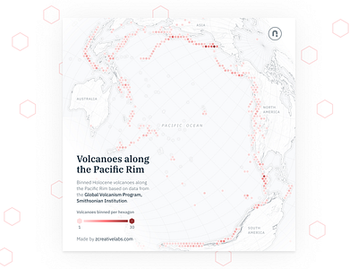
  2. Holocene volcanoes along the Pacific Rim cartography data visualization design geography hexagon map mapping red svg type typeface vector volcanoes
    View Holocene volcanoes along the Pacific Rim
    Holocene volcanoes along the Pacific Rim
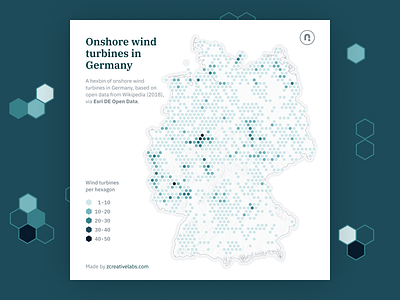
  3. Distribution of onshore wind turbines in Germany blue cartography d3 design geography hexagon map mapping maps svg teal vector
    View Distribution of onshore wind turbines in Germany
    Distribution of onshore wind turbines in Germany
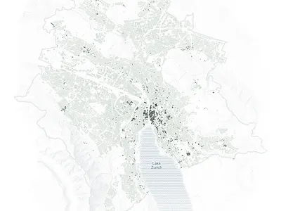
  4. Age of buildings in Zurich cartography data visualization design geography map mapping maps svg urban vector
    View Age of buildings in Zurich
    Age of buildings in Zurich
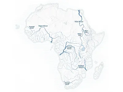
  5. Major rivers of Africa blue cartography d3 data visualization design geography map mapping maps svg vector
    View Major rivers of Africa
    Major rivers of Africa
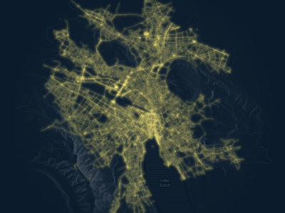
  6. Visualising all public lighting in the city of Zurich cartography city d3 dark ui data visualization design geography lights map mapping maps svg vector
    View Visualising all public lighting in the city of Zurich
    Visualising all public lighting in the city of Zurich
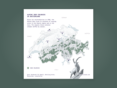
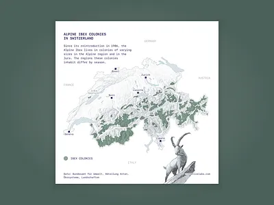
  7. Distribution of Ibex colonies in Switzerland alpine cartography data visualization design green ibex illustration map mapping svg type typeface vector
    View Distribution of Ibex colonies in Switzerland
    Distribution of Ibex colonies in Switzerland
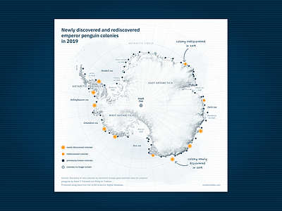
  8. Newly discovered and rediscovered emperor penguin colonies antarctica blue cartography data visualization design handwritten map penguin svg type ui vector yellow
    View Newly discovered and rediscovered emperor penguin colonies
    Newly discovered and rediscovered emperor penguin colonies
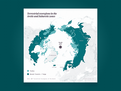
  9. Terrestrial ecoregions in the Arctic and Subarctic zones arctic cartography data visualization design ecoregion forest green map mapping maps svg vector
    View Terrestrial ecoregions in the Arctic and Subarctic zones
    Terrestrial ecoregions in the Arctic and Subarctic zones
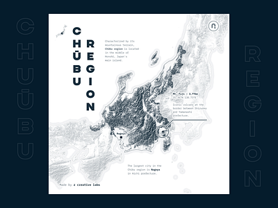
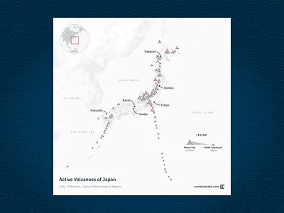
  10. Active volcanoes of Japan blue cartography dataviz gray japan map navy volcanoes waves white
    View Active volcanoes of Japan
    Active volcanoes of Japan
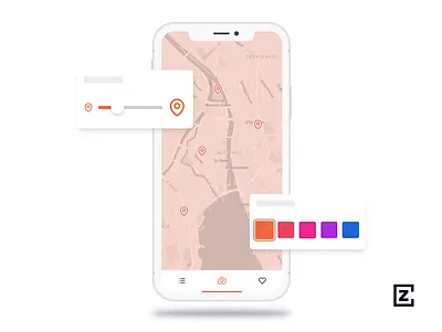
  11. Preview of device animation animation blue data visualization design iphone iphone x map maps mockup orange pink purple ui ux
    View Preview of device animation
    Preview of device animation
  12. Code design split screen visual animation code coding design line line chart pink svg
    View Code design split screen visual
    Code design split screen visual
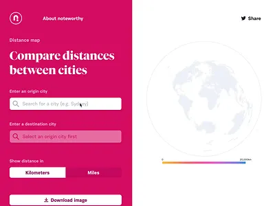
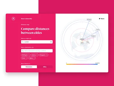
  13. Compare distances between cities cartography d3 data visualization design geography map mapping maps pink svg
    View Compare distances between cities
    Compare distances between cities
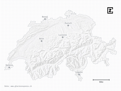
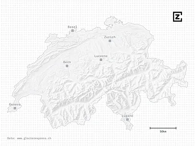
  14. A map of the Glacier Express through the Swiss Alps animation cartography design map mapping maps mountains red svg swiss switzerland
    View A map of the Glacier Express through the Swiss Alps
    A map of the Glacier Express through the Swiss Alps
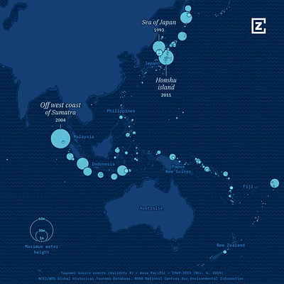
  15. Tsunami source events from 1969-present in Asia Pacific blue cartography design environment map mapping svg tsunami
    View Tsunami source events from 1969-present in Asia Pacific
    Tsunami source events from 1969-present in Asia Pacific
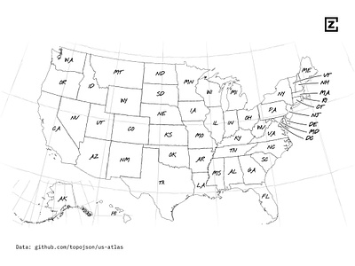
  16. Black and white map of the USA with state labels black blackandwhite design mapping maps pencil sketch svg white
    View Black and white map of the USA with state labels
    Black and white map of the USA with state labels
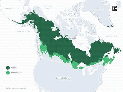
  17. A map of the North American boreal zone cartography design forest forestry green grey map mapping maps pattern svg
    View A map of the North American boreal zone
    A map of the North American boreal zone
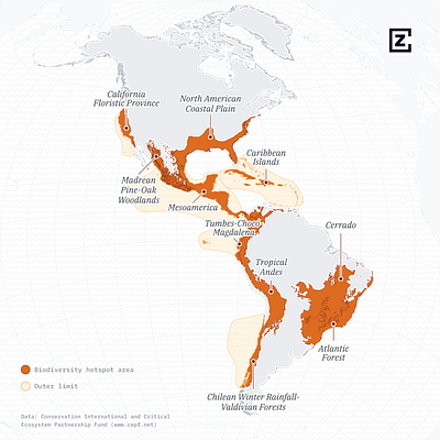
  18. A map of biodiversity hotspots in the Americas cartography data visulization data viz design map maps orange
    View A map of biodiversity hotspots in the Americas
    A map of biodiversity hotspots in the Americas
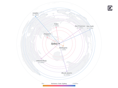
  19. A map showing relative distances of various cities from Sydney blue cartography design gradient map mapping pink purple
    View A map showing relative distances of various cities from Sydney
    A map showing relative distances of various cities from Sydney
Loading more…