


Maps of wine farms

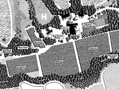


These maps are hand drawn and 100% to scale. I used photos, drone videos and irrigation maps to get it right. The different elements were drawn separately, scanned and then reassembled in Photoshop. To make the scale drawable, I had to make the original drawings pretty big. The first two are more than 3m wide and the third one is more than 6m. A huge job, but the results were well worth it. The final product was a set of limited edition archival prints that the client used as exclusive promotional gifts.