


7 Bike Routes
Okay, so if you've recently gotten into a visual programming language and you bought a bike, what's the logical next step? Merge the two pursuits.
There's an app called RunKeeper for the iPhone 3G/3GS that uses the GPS to track your route / elevation / time as you're out being active. If you upload your routes to the web site, you can get the data back out in a couple of XML formats.
Well hey, Processing can make quick work of that. So I've started hacking up an app to plot the data in 3D space. Very early stages, but it's working like a charm so far.
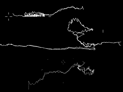
You're seeing three different views of the same 7 routes I've ridden over the past couple of days. The top is elevation as seen from the side, middle is close to being a straight down satellite-like view (you can see the distinctive duck's head outline of Stanley Park), and the bottom is a hybrid map + elevation view seen from an overhead angle.
I'm definitely seeing outlines of city features forming, although the elevation data around Stanley Park is seriously whacked. I think the cliffs obscure the GPS signal or something, cause it should be more or less flat sea level all the way around.