CNE Wayfinding Map

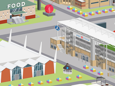
Redesigning the wayfinding map for the Canadian National Exhibition. Visitors found that the previous iteration of the map was confusing, as it viewed the site from above, showing only the tops of the buildings. In order for visitors to pinpoint their location and destination, they would need visual clues from the sides of the buildings. With this in mind the map was redrawn at a precise angle, showcasing the characteristics of the building facades as well as displaying the site as a whole.
I've finally got the full project up on Behance, check it out here: https://www.behance.net/gallery/102424597/CNE-Wayfinding-Map