Utrecht Transit Map

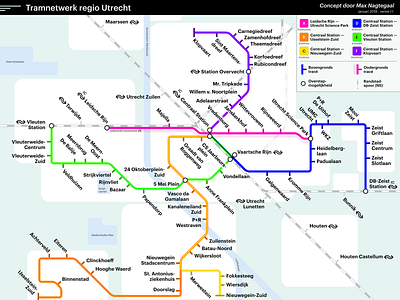
A conceptual transit map of the city of Utrecht, the Netherlands. There is a mobility issue in this city so I took the initiative to visualise a possible solution.
The network consists of only tram lines, with one tram tunnel going under the old city to the University campus. Read more in the blog post (Dutch): https://medium.com/@maxnagtegaal/een-nieuw-ov-systeem-voor-utrecht-94fcc1030cc4


