Paris illustrated map

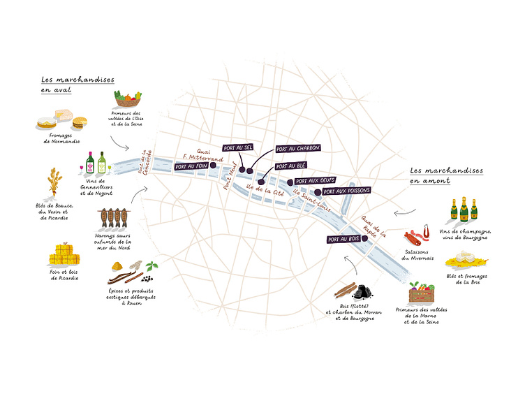
Illustrated map done for the book "Let's Eat Paris" by F.R. Gaudry and published by Marabout. It highlights the Seine river in Paris and its role as the main transport route for goods before the arrival of the railways.
Illustrated map done for the book "Let's Eat Paris" by F.R. Gaudry and published by Marabout. It highlights the Seine river in Paris and its role as the main transport route for goods before the arrival of the railways.


