


Js06

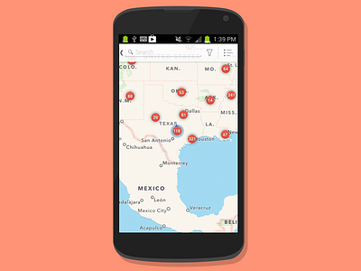
I created this design to assist with loading data while users moved around zoomed out areas on the map. We did not want to load individual pins for each location all over the country, so my recommended workflow was to group by area the further the user zoomed out. Here you can see the user has a few states visible so locations are grouped with a number on them. As the user zooms in, the dots begin to spread apart until eventually they get to a city level and can see the individual store pins.


