Public Transport Route Illustrated Maps (Bandung, Indonesia)

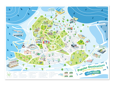
An Illustrated map of every Angkot's route (A form of Public Transport in Indonesia using a People Carrier Van) departing from Dago Terminal with popular destinations along its routes. I tried to capture the whole city of Bandung with its complicated road system to make a simple and concise map that can be easily read by anyone and this is the result. This project took much longer than expected because simplifying a map is actually quite difficult but i'm happy with how it's turned out.


